Chapter-wise syllabus of every software taught in this field -- tap a software to open it.
Engineering Drawing6 chapters · 34 topics+
Introduction to Engineering DrawingImportance of drawing as the language of engineersFreehand, instrument and computer drawing methodsDrawing instruments, sheet sizes and layoutTitle block and marginTypes of lines and their usesSingle-stroke lettering and numbering
Dimensioning and ScalesElements of dimensioning: dimension line, extension line, arrowheadsAligned and unidirectional dimensioningRepresentative fraction (RF)Plain scalesDiagonal scalesReading and setting out a scaled drawing
Geometric Constructions and Engineering CurvesBisecting lines and angles, drawing regular polygonsTangents and arcsEllipse by concentric circle and oblong methodsParabola and hyperbolaCycloid and involuteArchimedean spiral and helix
Orthographic ProjectionPrincipal planes and quadrantsFirst-angle and third-angle projectionProjection of pointsProjection of straight linesProjection of planesFront, top and side views of simple objects
Solids, Sections and Development of SurfacesProjection of prisms, pyramids, cylinders and conesSection planes and true shape of sectionSectional views and hatching conventionsDevelopment of lateral surfacesIntersection of simple solids
Isometric Drawing and Practice SheetsIsometric scale and isometric axesIsometric view of blocks, cylinders and simple machine partsConverting pictorial views to orthographic viewsReading a building and a machine drawingPractice sheets and final drawing test
CALS (Computer Aided Land Survey) Using Civil 3D6 chapters · 27 topics+
Introduction to Land Survey and Civil 3DLand survey basicsAbout AutoCAD Civil 3DPoint creation – miscellaneous, intersection and slope
Working with PointsImport points from ExcelConvert AutoCAD pointsPoint stylePoint label stylePoint group
Surface CreationFrom a points file (Excel)From Total Station survey dataFrom LiDAR dataFrom Google EarthFrom DEM files
Surface Style and AnalysisSurface styleCreate points from a surfaceUser-defined contoursDirection and elevation analysisSlope and slope arrowsWatershed and water dropCatchment area
Earthwork CalculationCut and fill volumeGrading surfaceProfile view generation
Site LayoutParcel from objectsRight of way (ROW)Parcel from layoutTable creation
Getting Started with AutoCADAutoCAD interface: ribbon, command line, status barStarting, saving and opening drawings (DWG)Units, limits and drawing setupZoom, pan and navigationSelecting objects and command options
Precision Drawing ToolsAbsolute, relative and polar coordinatesLine, circle, arc, rectangle, polygon, ellipsePolyline and splineObject Snap, Ortho, Polar Tracking and Object Snap TrackingDynamic input
Modifying DrawingsMove, copy, rotate, mirror and scaleTrim, extend, offset and stretchFillet, chamfer, break and joinRectangular, polar and path arraysGrips and the Properties palette
Drawing OrganisationLayers and Layer Properties ManagerColour, linetype and lineweightMatch Properties and layer toolsHatch and gradient fillsGroups and object visibility
AnnotationText styles, single-line and multiline textDimension stylesLinear, aligned, angular, radius and diameter dimensionsLeaders and multileadersTables and annotative scaling
Blocks and Reusable ContentCreating and inserting blocksBlock attributes and title blocksDesign Center and Tool PalettesExternal references (Xrefs)Inquiry tools: distance, area, list
Layouts, Plotting and ProjectModel space and paper spaceLayouts and viewports at scalePage setup, plot styles and PDF outputProject: field-specific working drawingCertificate assessment
3D Workspace and Navigation3D Modeling workspaceViewCube, orbit and Steering WheelsVisual stylesUser Coordinate System (UCS) in 3DViewports for 3D work
Solid ModellingSolid primitives: box, cylinder, cone, sphere, wedgeExtrude, revolve, sweep and loftPresspullUnion, subtract and intersectFillet edge and chamfer edge
Editing Solids, Surfaces and MeshesSolid editing: faces, edges and shellSlice and section planes3D move, 3D rotate, 3D mirror and 3D arraySurface and mesh basicsConverting between mesh, surface and solid
Visualisation, Drawings and PracticeMaterials Browser and lightsBasic renderingBase, projected and section views from 3DPractice model in your fieldCertificate assessment
Getting Started with AutoCADUser interface: ribbon, application menu, Quick Access ToolbarCommand line, dynamic input and status barCreating, opening and saving drawings and templatesUnits, limits and drawing settingsZoom, pan and navigation
Drawing Basics and Precision ToolsAbsolute, relative and polar coordinatesLine, circle, arc, rectangle and polygonObject snaps and object snap trackingOrtho, polar tracking and grid/snapPolyline, ellipse and spline
Editing and Modifying ObjectsSelection methodsMove, copy, rotate, scale and mirrorTrim, extend, offset and fillet/chamferRectangular, polar and path arraysStretch, break, join and explodeEditing with grips and the Properties palette
Layers and Object PropertiesLayer Properties ManagerColour, line type and line weightLayer states, freeze, lock and isolateMatch Properties and Quick Select
Annotation: Text, Hatching and TablesText styles, single-line and multiline textHatch and gradient fillsTables and table stylesAnnotative objects and annotation scale
DimensioningDimension stylesLinear, aligned, angular, radius and diameter dimensionsBaseline and continue dimensionsMultileaders and tolerancesEditing dimensions
Blocks, Attributes and ReferencesCreating and inserting blocksBlock attributes and attribute extractionDynamic blocks (introduction)External references (Xref) and imagesDesignCenter and tool palettes
Layouts, Viewports and PlottingModel space and paper spaceCreating layouts and viewportsViewport scale and lockingPage setup, plot styles and plotting to PDF
3D Modeling Basics3D Modeling workspace and visual stylesUCS and viewing in 3D (ViewCube, orbit)Solid primitives: box, cylinder, cone, sphere, wedgeExtrude, revolve, sweep and loftUnion, subtract and intersect
3D Editing, Views and Final ProjectPresspull, fillet edge, chamfer edge and shell3D move, 3D rotate, 3D mirror and 3D arraySection planes and flatshotCreating drawing views from a 3D modelFinal 2D and 3D project with plotted output
Introduction to AutoCADIntroduction to AutoCAD HistoryExploring GUI (Graphical User Interface)Understanding the AutoCAD terminologyHow to install AutoCAD Student LicenseUnderstanding the AutoCAD Workspace
Understanding the File Management OperationsStarting a NEW AutoCAD File with NEW, QNew and STARTUPOpen existing Drawing fileSecure your file data with SAVE & SaveASUnderstanding the AutoSave optionSaving file in other versionUnderstanding the AutoCAD file formatQuiting AutoCAD- close,Exit/Quit
Basic OperationsWorking with MouseUnderstanding the Co-ordinate SystemWorking with Co-ordinate SystemUnderstanding object selection methodWorking with Drawing Setting- Units, limits & Displaying GridUnderstanding the Drafting SettingLines- You Will Use Them EverywhereErase Unused objectsUnderstanding the Undo & Redo Operations
Display Control commandsUnderstanding the Zoom CommandsUnderstanding the Zoom FactorUnderstanding the PAN & MBUTTONPANUnderstanding Regen & Viewres
Drawing and Drafting toolsPolyline and their usesSpline and their usesUsing Different types of CircleUsing Different types of ArcUsing Rectangle in Depth lookUsing Ellipse (Center, Axis-End & Ellipticle Arc)Using Polygon in Depth lookUnderstanding the Construction line and Ray lineUnderstanding the Point and their stylesDivide – Measure –Not What You Would ThinkUnderstanding the Donut, Revision Cloud and Fill
Modify objects-Manipulation CommandsUnderstanding and Using Copy CommandUnderstanding and Using Move CommandDeleting duplicate objectsUnderstanding and Using Rotate CommandUnderstanding and Using Mirror CommandUnderstanding and Using Stretch CommandUnderstanding and Using Scale CommandUnderstanding and Using Offset CommandFillet object cornersChamfer object cornersTrimming and Extending linesUnderstanding Array CommandUsing Rectangular ArrayUsing Polar ArrayUsing Path ArrayUnderstanding the Exploding ObjectsBreaking and Joining ObjectsWorking with Multi-function GripsModify Associative Array
Changing Objects PropertiesAssigning Object ColorUnderstanding the Line TypesAssigning Line TypesAssigning Object Line WeightChecking and Modifying Object PropertiesUnderstanding the Match Type Properties
Object visibilityHide – Isolate – End Isolation On Selected ObjectsTransparency – Old Thing Just Fade AwayLine Type Scale – Scale Size Is RelativeUnderstanding the Draw Order
Using Layer ManagementCreating and Editing LayersAssigning New Layers in Existing ObjectHow to Save Layers ?Opening Save Layer in Existing DrawingsUsing Layers to Plot ControlFreeze Or Thaw, On Or Off And Locking LayersUnderstanding Layer in AutoCAD
DimensioningUnderstanding Dimensioning conceptUsing Basic Dimensions (Linear, Aligned, Arc Length, Ordinate, Radius, Diameter, Jogged and Angular)Understanding and Using Continue & Baseline dimensionsAdding tolerance Dimensions in the ObjectAdding Center markCreating and Modifying Dimension style in Depth LookUsing the Dimension Edit and Dimension Text EditUnderstanding and Using leader DimensionUnderstanding and Using Mltileader DimensionUnderstanding and Using Mltileader Style Dimension
Hatch and GradientUnderstanding Hatching conceptCreating Basic HatchesHatching in Depth lookUsing GradientMirror Hatch
Working with Text and tableCreating Single Line TextCreating Multiline TextCreating and Modifiyig Text StyleUsing Mirror TextChecking SpellingCreating tableEditing TableCreating & Modifying Table StyleModifying TextUnderstanding Text Concept in AutoCAD
Working with Block and WblockCreate & Insert BlockCreate WBlockCreate Wblock using BaseEdit, Save & Save As Block
Working with Clipboard ToolsUsing Cut, Copy and Copy with Base PointUsing Paste ClipUsing Paste As BlockUsing Copy Link and Paste original Co-ordinateUsing Paste SpecialUsing Hyperlink & Paste Hyperlink
Utilities & Inquiry ToolsUsing ID PointUsing List CommandUsing Measuregeom command(Distance, Radius, Angle, Area & Volume)
Understanding the Model Space, Paper or Layout Space and PlottingWhat is the Difference Between Printing and Plotting?Under Drawing Spaces (Model Space & Paper Space)Using Page setup for LayoutMaking and clipping viewportsAdding Layout with Title BlockInserting Title Block on LayoutAdding Annotation on a LayoutPrinting or Plotting from Model space and Paper SpaceUnderstanding Plotstyle
Advance OperationsUsing Design Center PalettesUsing Tool PalettesUnderstanding & Using QSELECTSelect Similar – Pick It OnceAdd Select - Start a Command when you don't have toRenaming objectsUsing Quick Calculator
Getting Started with 3D ModelingIntroduction to AutoCAD 3D interfaceSetup 3D WorkspaceUnderstanding the View Cube and Orbit ToolsUnderstanding the 3D Object SnapUnderstanding the Visual StylesUnderstanding Allow/ Disallow Dynamic UCSManipulating the User Co-ordinate SystemUnderstanding Viewport Configuration
Creating Solid 3D Objectsworking with Solid Primitives
Creating 3D Objects from 2D ProfilesUnderstanding the 2D Profiles and its worksUsing the Extrude CommandUsing the Revolve commandUsing the Loft CommandUsing the Sweep commandUsing the Polysolid CommandUsing the Press-pull Command
Modifying 3D ObjectsUsing Gizmo Command- Move, Rotate and ScaleUsing object CullingMirroring and Aligning object in 3DCreating a Composite Solid- Using Boollion Operation: Union, Substract and IntersectAdding a Chamfer/ Chamfer Edge and Fillet/ Fillet EdgeEditing Entire Solid- Separating and Shelling Solids
Rendering and presentationAssigning Material to 3D ObjectModifying Material PropertiesAdding Sun, Geolocation, date and timeAdding Lights-Point, Spot, Web and Distance lightModifying Light Properties using with Light listAdding environment- Display, Sky background and ShadowCreating and Modifying Camera ViewCreating Named ViewCreating and Saving renderings as image file
Session 1: Surveying Fundamentals (Theory)Introduction About SurveyingHistory of SurveyRole of Land SurveyorsUnderstanding the Instruments HandlingSafety PrecautionsUnderstanding the Scaling Concept & It's Types
Session 1: Surveying Fundamentals (Practical)How to Handle and Use of Surveying Instrument'sSafety Rules During the SurveyingMeasurements by Using the Tape and ScaleUnderstanding the Unit Conversion
AutoCAD Professional (2D+3D)32 chapters · 217 topics+
2DAutoCAD 2D
13 chapters · 107 topics
Introduction to AutoCADIntroduction to AutoCAD HistoryExploring GUI (Graphical User Interface)Understanding the AutoCAD terminologyHow to install AutoCAD Student LicenseUnderstanding the AutoCAD Workspace
Understanding the File Management OperationsStarting a NEW AutoCAD File with NEW, QNew and STARTUPOpen existing Drawing fileSecure your file data with SAVE & SaveASUnderstanding the AutoSave optionSaving file in other versionUnderstanding the AutoCAD file formatQuiting AutoCAD- close,Exit/Quit
Basic OperationsWorking with MouseUnderstanding the Co-ordinate SystemWorking with Co-ordinate SystemUnderstanding object selection methodWorking with Drawing Setting- 1. Units 2. limits 3. Displaying GridUnderstanding the Drafting SettingLines- You Will Use Them EverywhereErase Unused objectsWorking With Entering CommandsUnderstanding the Undo & Redo Operations
Display Control commandsUnderstanding the Zoom CommandsUnderstanding the Zoom FactorUnderstanding the PAN & MBUTTONPANUnderstanding Regen & ViewresUnderstanding the Concept behind the Zoom
Drawing and Drafting toolsPolyline and their usesSpline and their usesUsing Different types of CircleUsing Different types of ArcUsing Rectangle in Depth lookUsing Ellipse (Center, Axis-End & Ellipticle Arc)Using Polygon in Depth lookUnderstanding the Construction line and Ray lineUnderstanding the Point and their stylesDivide – Measure –Not What You Would ThinkUnderstanding the Donut, Revision Cloud and Fill
Modify objects-Manipulation CommandsUnderstanding and Using Copy CommandUnderstanding and Using Move CommandDeleting duplicate objectsUnderstanding and Using Rotate CommandUnderstanding and Using Mirror CommandUnderstanding and Using Stretch CommandUnderstanding and Using Scale CommandUnderstanding and Using Offset CommandFillet object cornersChamfer object cornersTrimming and Extending linesUnderstanding Array CommandUsing Rectangular ArrayUsing Polar ArrayUsing Path ArrayModify Associative ArrayUnderstanding the Exploding ObjectsBreaking and Joining ObjectsWorking with Multi-function Grips
Creating Isometric DrawingsUnderstanding the Basic Concept of Isometric DrawingUnderstanding the Isometric SettingsUnderstanding the ISOPLANECreating ISO Circle and ISO lineUnderstanding the concept to Creating Isometric Views
Changing Objects PropertiesAssigning Object ColorUnderstanding the Line TypesAssigning Line TypesAssigning Object Line WeightChecking and Modifying Object PropertiesUnderstanding the Match Type Properties
Object visibilityHide – Isolate – End Isolation On Selected ObjectsTransparency – Old Thing Just Fade AwayLine Type Scale – Scale Size Is RelativeUnderstanding the Draw Order
Working with Text and tableUnderstanding Text Concept in AutoCADCreating and Modifiyig Text StyleCreating Single Line TextCreating Multiline TextModifying TextChecking SpellingUsing Mirror TextCreating & Modifying Table StyleCreating tableLinking Table to MSExcelEditing Table
Hatch and GradientUnderstanding Hatching conceptCreating Basic HatchesHatching in Depth lookUsing GradientMirror Hatch
DimensioningUnderstanding Dimensioning conceptUsing Basic Dimensions (Linear, Aligned, Arc Length, Ordinate, Radius, Diameter, Jogged and Angular)Understanding and Using Continue & Baseline dimensionsAdding tolerance Dimensions in the ObjectAdding Center markCreating and Modifying Dimension style in Depth LookUsing the Dimension Edit and Dimension Text EditUnderstanding and Using leader DimensionUnderstanding and Using Mltileader DimensionUnderstanding and Using Mltileader Style Dimension
Understanding the Model Space, Paper or Layout Space and PlottingWhat is the Difference Between Printing and Plotting?Under Drawing Spaces (Model Space & Paper Space)Using Page setup for LayoutMaking and clipping viewportsAdding Layout with Title BlockInserting Title Block on LayoutAdding Annotation on a LayoutPrinting or Plotting from Model space and Paper SpaceUnderstanding Plotstyle
PTAutoCAD PT
12 chapters · 58 topics
Working with Block and WblockCreate & Insert BlockCreate WBlockCreate Wblock using BaseEdit, Save & Save As Block
Working with Attribute BlocksDefining Attribute BlockBlock Attribute ManagerModifying Block Attribute Definitions
Creating Parametric DrawingUnderstanding Parametric Drawing and ConstraintsApplying Geometric constraintsApplying Dimensional constraintsHide/Show and Delete ConstraintsConverting Dimensions into Dimensional ConstraintsChanging Dimensional Constraints using Grip Editing
Working with Dynamic block
Utilities & Inquiry ToolsUsing ID PointUsing List CommandUsing Measuregeom command(Distance, Radius, Angle, Area & Volume)
Working with Clipboard ToolsUsing Cut, Copy and Copy with Base PointUsing Paste ClipUsing Paste As BlockUsing Copy Link and Paste original Co-ordinateUsing Paste SpecialUsing Hyperlink & Paste Hyperlink
Using Layer ManagementUnderstanding Layer in AutoCADCreating and Editing LayersAssigning New Layers in Existing ObjectUsing Layers to Plot ControlFreeze Or Thaw, On Or Off And Locking LayersHow to Save Layers ?Opening Save Layer in Existing Drawings
OLE (Object Linking Embedding) conceptUnderstanding OLE ConceptLinking & Embedding Object into AutoCADLinking Data using Paste LinkUsing OLE LinksOpening OLE Source and Using OLE ScaleUsing OLE Hide & OLE FrameUsing OLE Quality & OLE Startup
Working with Existing DrawingUnderstanding external referencesAttaching External ReferencesEditing External References objectUsing external references Palettes
Sliding & ScriptingCreating and Saving SlidesOpening and using slidesCreating Script fileRunning Script fileCreating a Simple Project using with Script
Working with Annotative ScalingUnderstanding Annotation ScalingAdding Hatch with AnnotativeAdding Dim with AnnotativeAdding Text with AnnotativeAdding MLeader with AnnotativeAdding Block with Annotative
Advance OperationsUsing Design Center PalettesUsing Tool PalettesUnderstanding & Using QSELECTSelect Similar – Pick It OnceAdd Select - Start a Command when you don't have toRenaming objectsUsing Quick Calculator
3DAutoCAD 3D
7 chapters · 52 topics
Getting Started with 3D ModelingIntroduction to AutoCAD 3D interfaceSetup 3D WorkspaceUnderstanding the View Cube and Orbit ToolsUnderstanding the 3D Object SnapUnderstanding the Visual StylesUnderstanding Allow/ Disallow Dynamic UCSManipulating the User Co-ordinate SystemUnderstanding Viewport Configuration
Creating Solid 3D Objectsworking with Solid Primitives
Creating 3D Objects from 2D ProfilesUnderstanding the 2D Profiles and its worksUsing the Extrude CommandUsing the Revolve commandUsing the Loft CommandUsing the Sweep commandUsing the Polysolid CommandUsing the Press-pull Command
Working with Meshing ToolsControlling mesh primitive optionUsing Revolved Mesh, Edge Mesh, Ruled Mesh & Tabulated MeshSmoothing Mesh with Smooth Object, Smooth More, Smooth Less & Refining MeshUsing Adding/Removing a Crease and Controlling mesh Tessellation option commandUsing Extruding, splitting and Merging mesh faces CommandUsing Creating & Closing a Hole in a Mesh, Collapsing a Face/Edge and Spinning a Triangle Face CommandUsing Converting a Mesh to a Solid and Surface CommandConverting 3D Object in to a Mesh
Modifying 3D ObjectsUsing Gizmo Command- Move, Rotate and ScaleUsing object CullingMirroring and Aligning object in 3DMirroring and Aligning object in 3DCreating a Composite Solid- Using Boollion Operation: Union, Substract and IntersectAdding a Chamfer/ Chamfer Edge and Fillet/ Fillet EdgeEditing Edges of a Solid - Extracting, Imprinting, Coloring and Copying EdgesEditing Faces of a Solid- Extruding, Tapering, Moving/Offsetting, Copying, Deleting, Rotating and Coloring facesEditing Entire Solid- Separating and Shelling SolidsChecking Solids for Interference, Slicing Solids and Thickening SurfaceCreating a Curve using Offsetting EdgesAdding Automatic 2D Profile Views From 3D Solid View
Working with Surface ToolsCreating a Surface with Network, Lofted, Swept, Planer, Extruded and Revolved Surface CommandCreating a Blend, Patch and Offset SurfaceConverting a Surface into a Nurbs SurfaceEditing Control Vertices on a Nurbs SurfaceDisplaying and Hiding Control Vertices on Nurbs SurfaceRebuilding, Adding and Removing Control VerticesProjecting curves on to a Surface
Rendering and presentationAssigning Material to 3D ObjectModifying Material PropertiesAdding Sun, Geolocation, date and timeAdding Lights-Point, Spot, Web and Distance lightModifying Light Properties using with Light listAdding environment- Display, Sky background and ShadowCreating and Modifying Camera ViewCreating Named ViewCreating and Saving renderings as image file
Getting StartedCourse overviewHow to Get the softwareTips: How to Crack this examUnderstanding the Exam objectivesResources: for Exam Prepartion
Advanced Drawing ObjectsCreatIng and working with Polylines: Part 1CreatIng and working with Polylines: Part 2Creating and modifying ArcsCreating and Working with PolygonsWorking with Splines: Part 1Working with Splines: Part 2Creating and working with RegionsCreating and Working with RaysCreating and working with XlinesCreating and Working with Multilines: Part 1Creating and Working with Multilines: Part 2Creating 2D isometric Drawings
Organize ObjectsSelecting and Organizing ObjectsManaging Layers with Layer StatesUsing Layer FiltersHave You Tried: Creating and Applying a Layer FilterApplying and Removing Layer OverridesUsing the Layer Walk toolMerging and Removing Layers StepPractice Exercise
Draw with AccuracyControl the User Coordinate SystemUnderstanding and Editing Multifunctional GripsUnderstanding the Concept of HatchingHave You Tried Hatch and Hatch Editing StepPractice Exercise
Layouts, Printing, and OutputsCreating and Managing Layouts and ViewportsHave You Tried Create and Import Page SetupsPublishing DrawingsCreate a Zipped Transmittal Package
Annotation techniquesCreating and Modifying Revision CloudsWorking with WipeoutsComparing DrawingsFormating text: Part 1Formating Text: Part 2Using Tables in DrawingsCreating and Adjusting Multileaders and LeadersHave You Tried Multileaders for Labels and CalloutsCreating and Editing Annotation with Advanced Dimensioning TechniquesHave You Tried Creating Dimensions Quickly and EfficientlyApply Annotative Properties and Styles
Reusable Content and Drawing ManagementCreating Blocks and Apply AttributesHave You Tried Working with Attributes in BlocksControl External References and Properties of Referenced LayersCreating a Hyperlink to Another FileWorking with GroupsPractice exercise
Productivity tipsHow to Work with Smarter not HarderHave You Tried Creating Tools on Tool
Civil 3D Interface and Project SetupCivil 3D workflow and object-based designToolspace: Prospector, Settings and Survey tabsDrawing settings, units and coordinate systemObject styles and label stylesTemplates and data shortcuts
Survey Data and PointsImporting points from text and CSV filesPoint styles and point label stylesPoint groupsDescription keysEditing points and creating points manuallySurvey figures and linework basics
SurfacesCreating TIN surfaces from pointsAdding breaklines and boundariesContour and triangle display stylesSurface editing: delete lines, swap edges, smoothingElevation and slope analysisSurface labels and volume surfaces
AlignmentsAlignment creation tools and layout toolbarLines, curves and spiralsDesign criteria and design checksStation labels and alignment tablesEditing alignments with grips and the Alignment Grid View
Profiles and Profile ViewsExisting ground profile from surfaceProfile views and bandsDesigning a finished ground profile with vertical curvesProfile labels and editingSuperimposed profiles
Assemblies and CorridorsSubassemblies from the tool paletteCreating a road assembly with lanes, shoulders and daylightBuilding a corridor and setting frequencyCorridor targets and regionsCorridor surfacesIntersections and cul-de-sacs basics
Sections and Quantity TakeoffSample linesSection views and section view groupsMaterials list and cut/fill computationMass haul diagramVolume reports and quantity takeoff
Grading, Feature Lines and ParcelsFeature lines and sitesGrading criteria and grading groupsPad and pond gradingCreating and editing parcelsParcel labels and area tables
Pipe NetworksParts lists for pipes and structuresCreating gravity pipe networksEditing pipes in plan and profilePipe network labels and tablesInterference checkPressure network basics
Plan Production and Final ProjectView frames and match linesPlan and profile sheet creationAnnotation and sheet set setupExporting data and reportsComplete road project from survey to sheets
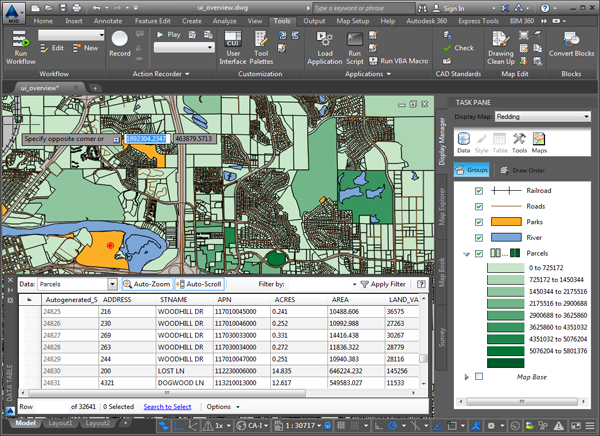
Introduction to AutoCAD Map 3D and GISCAD and GIS: what Map 3D adds to AutoCADPlanning and Analysis workspaceMap Task Pane overviewDisplay Manager, Map Explorer and Map Book tabsVector and raster data types
Coordinate SystemsGeographic and projected coordinate systemsAssigning a coordinate system to a drawingCoordinate transformation between systemsLibrary of coordinate systemsGeolocation and online maps
Connecting to GIS Data (FDO)Data Connect and FDO providersWorking with SHP and SDF filesSQLite and other database sourcesInserting and correcting raster imagesWMS and web data sourcesFeature classes and schemas
Drawing CleanupWhy clean drawings matter in GISDelete duplicates and erase short objectsBreak crossing objectsExtend undershoots and snap clustered nodesDissolve pseudo nodes and simplify objects
Object Data and AttributesDefining object data tablesAttaching object data to objectsEditing and exporting object dataLinking to external database tablesConverting object data to feature attributes
TopologyNode, network and polygon topologyCreating topology from lineworkEditing and querying topologyShortest path and flood tracePolygon overlay basics
Drawing Queries and Project ManagementAttaching source drawingsLocation, property, data and SQL queriesQuery modes: preview, draw and reportSaving and reusing queriesSaving changes back to source drawings
Feature Editing and AnalysisCreating and editing GIS featuresChecking out and checking in featuresBuffer analysisOverlay analysisSurfaces from DEM data and elevation styling
Styling, Thematic Maps and AnnotationStyle Editor and scale rangesTheming by attribute valuesFeature labels and annotation templatesLegends, north arrow and scale barLayer styles and saving layers
Map Books, Export and Final ProjectMap book templates and tilesCreating a map bookMAPEXPORT and MAPIMPORT to GIS formatsPlotting and PDF outputFinal project: utility or land-use map from raw data
Introduction to GIS and ArcGISWhat GIS is and where it is usedVector and raster data modelsArcGIS platform overview: ArcGIS Pro and ArcGIS OnlineArcGIS Pro interface, projects, maps and Catalog pane
Coordinate Systems and DataGeographic and projected coordinate systemsProjections and the Project toolShapefiles, geodatabases and feature classesAdding data from files, tables and online sources
Georeferencing and DigitisingGeoreferencing scanned maps and imagesCreating feature classesDigitising points, lines and polygonsEditing tools and snapping
Attribute DataAttribute tables and field typesCalculate Field and Calculate GeometryTable joins and relatesSelect by attributes and select by location
Symbology and LabellingSingle, unique value and graduated symbologyLabelling and label classesDefinition queriesLayer files and styles
Spatial Analysis and GeoprocessingBuffer, clip, intersect, union and dissolveSpatial joinModelBuilder basicsGeoprocessing history and environments
Raster and Terrain AnalysisWorking with satellite images and DEMsContours, slope, aspect and hillshadeRaster calculator and reclassifyBasic land use classification concepts
Map Layout and SharingLayouts, map frames and gridsLegend, scale bar, north arrow and textExporting maps to PDF and imagesSharing maps to ArcGIS Online
GIS ProjectStudy area mapping projectAnalysis and map productionProject presentation
Getting Started with AutoCADAutoCAD interface, ribbon and workspacesDrawing units, limits and templatesCoordinate systems: absolute, relative and polarOpening, saving and managing drawing files (.dwg)
Drawing and Precision ToolsLINE, CIRCLE, ARC, RECTANGLE and POLYGONPolylines, splines and ellipsesObject snaps, polar tracking and object snap trackingDynamic input and drafting settings
Modifying ObjectsMOVE, COPY, ROTATE, SCALE and MIRROROFFSET, TRIM, EXTEND, FILLET and CHAMFERRectangular, polar and path arraysGrips, selection methods and object properties
Layers and Drawing OrganisationCreating and managing layersLinetypes, lineweights and coloursLayer states and layer filtersDesign Center and tool palettes
Annotation: Text, Dimensions and TablesText styles, single-line and multiline textDimension styles and dimensioning commandsLeaders, multileaders and tolerancesTables and fields
Hatching, Blocks and AttributesHatch and gradient patternsCreating and inserting blocksDynamic blocksAttributes and extracting block data
References and CollaborationExternal references (Xrefs)Attaching images and PDF underlaysSheet Set Manager basicseTransmit and sharing drawings
Layouts, Viewports and PlottingModel space and paper spaceLayouts, title blocks and viewportsAnnotative scalingPage setup, plot styles and PDF output
Isometric and Parametric DrawingIsometric draftingGeometric constraintsDimensional constraints and parameters
3D Modelling3D workspace, UCS and viewsSolid primitives, EXTRUDE, REVOLVE, SWEEP and LOFTBoolean operations: UNION, SUBTRACT and INTERSECTEditing solids, surfaces and meshes
3D Drawings, Visualisation and RenderingVisual styles and section planes2D drawings from 3D models (views)Materials, lights and rendering
Productivity and Final ProjectCAD standards, templates and drawing checksCustomising the interface and shortcutsFinal project: a complete 2D and 3D drawing setCourse review and practice test

 Engineering Drawing
 CALS (Computer Aided Land Survey) Using Civil 3D
 AutoCAD 2D
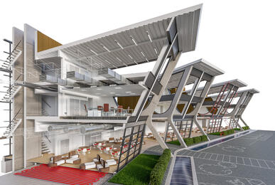 AutoCAD 3D
 AutoCAD User (2D+3D)
 AutoCAD Associate (2D+3D)
 Land Survey
 AutoCAD Professional (2D+3D)
 Autodesk Certified Professional: AutoCAD Exam Prep
 AutoCAD Civil 3D
 AutoCAD Map 3D
 ArcGIS
_010624043919987427.png) AutoCAD Master